Civil 3D UDP Sync
Icon: |
|
| Ribbon: | Site Tab > Points Panel > Update Points dropdown > Civil 3D UDP Sync |
| Ribbon: | Survey Tab > Civil 3D COGO Point Tools Panel > Civil 3D Points Link dropdown > Civil 3D UDP Sync |
Introduction
When Civil 3D Points are linked to the software, additional Point Properties can to associated with the Civil 3D points. This can be useful for documenting/reporting/displaying non-geometric properties picked up for the point.
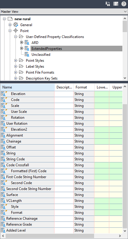
This command will append Point Properties to Civil 3D points, by creating a User-Defined Property Classification in Civil 3D.
The User-Defined Property Classification will be named Extended Properties and will contain all Point Properties assigned by this software.
Note: This command requires that the user first run the Create Survey Strings command for form a link between the Civil 3D points and the software, or use the Civil 3D Points Link command.
Details
Upon selecting the command:
- A User-Defined Property classification will be created, named Extended Properties
- The assigned Point Properties (assigned via Point Styles the software assigns to the Codes of the Civil 3D points) will be added to the User-Defined Property Classification list. Each Point Property will be created with a matching Name in the classification list
- If already created, the information will be updated for each Civil 3D COGO Point.